
SERVICE COVERAGE
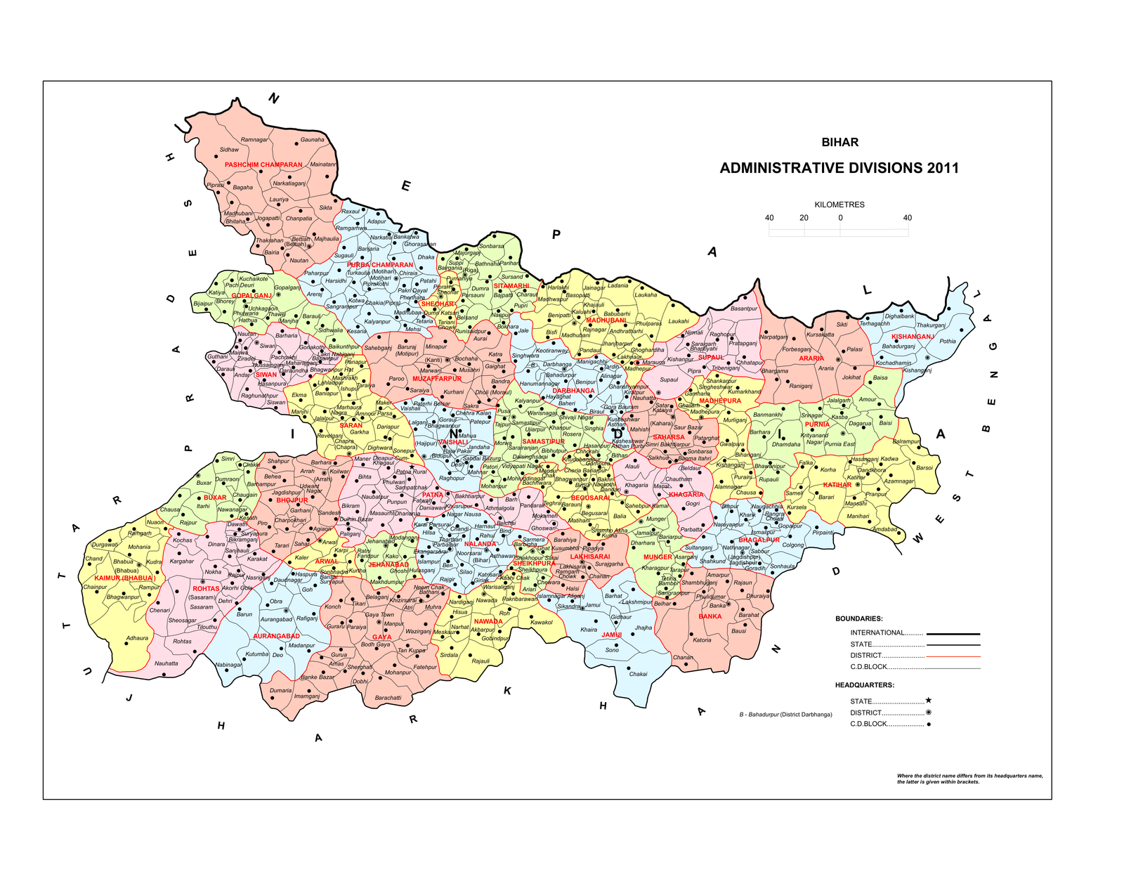
Bihar Administrative Map
Explore Bihar’s districts and community development blocks. BhumVerify supports land verification across the state — from Pashchim Champaran to Kishanganj.
All 38 districts. Local expertise.
STATE MAP
Districts & blocks across Bihar
HOW TO READ
What this map shows
- District boundaries in red, with district names labelled across the state
- C.D. Block names and headquarters for finer local context
- Neighbouring regions: Nepal (north), Uttar Pradesh (west), Jharkhand (south), West Bengal (east)
When you request a callback or start a verification, choose your district so our team can focus on the right local records.
Need verification in your district?
Request a callback →Tell us your location — we handle the rest.